Near Disaster in the Desert!!

Disclaimer: Links on this page pointing to Amazon, eBay and other sites may include affiliate code. If you click them and make a purchase, we may earn a small commission.

OP
OP
John M BUNMAN

John M BUNMAN

BUNMAN-Adventures, Rescue & Recovery
Joined
Sep 5, 2020
Posts
7,293
Reaction score
39,031
Location
Las Vegas NV
Great write up, glad they were found. Cell phone signals are REALLY strange at times. I once had my phone beep and tell me it had a Wi-Fi signal when I was on the Appalachian trail on a high ridge at least 3/4 of a mile from anything. I'm assuming the signals randomly bounce at times?
I’ve always wanted to section hike the Appalachian, hopefully I’ll be able to hike again at all by next year.
Love to see some pictures from your App Adventures. I’ve heard it’s Amazing country.
One day maybe? I’ve sectioned some of the JMT and PCT. Spectacular Country
 

Oldfart

FRF Addict
Joined
Oct 21, 2017
Posts
5,968
Reaction score
14,799
Location
Saggy Balls Division of Trump Army
I’ve always wanted to section hike the Appalachian, hopefully I’ll be able to hike again at all by next year.
Love to see some pictures from your App Adventures. I’ve heard it’s Amazing country.
One day maybe? I’ve sectioned some of the JMT and PCT. Spectacular Country
I'm only personally familiar with the sections in this region, it's very nice here. My buddy's son hiked about half of it starting from the southern end. He did 2 months while on a break from college. He went to college on a cross country scholarship, so he was in really good shape.

1665526003210.jpeg

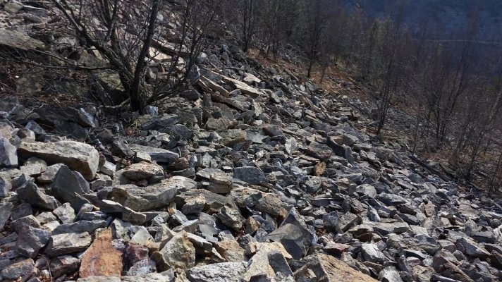
You have to be pretty careful in the rocky areas. A small trip is definitely going to leave a mark! I always use carbon fiber walking sticks.
1665525970325.jpeg

1665526777481.jpeg

1665526861958.jpeg

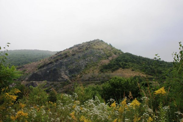
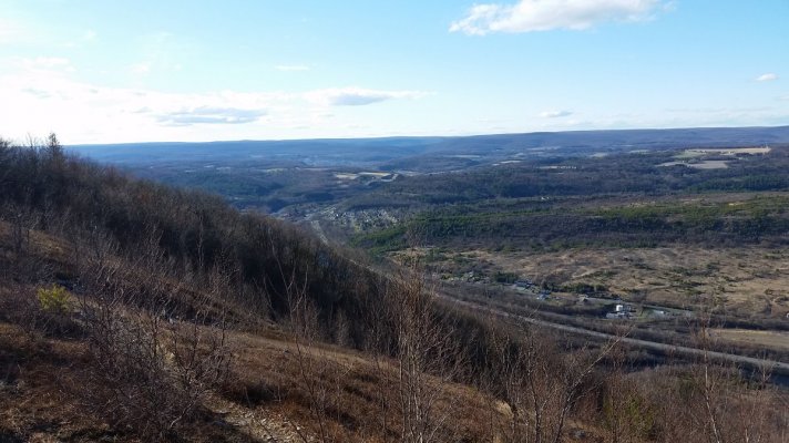
That's actually the trail directly in the middle, you can see a small break in the trees on the far side as it keeps dropping down.
1665527239281.jpeg
 
Last edited:

Oldfart

FRF Addict
Joined
Oct 21, 2017
Posts
5,968
Reaction score
14,799
Location
Saggy Balls Division of Trump Army
1665527340673.jpeg

1665527466204.jpeg

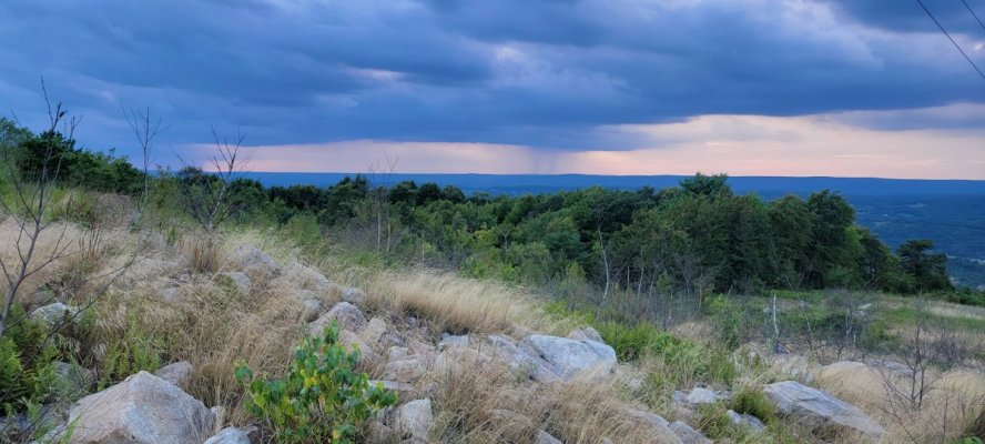
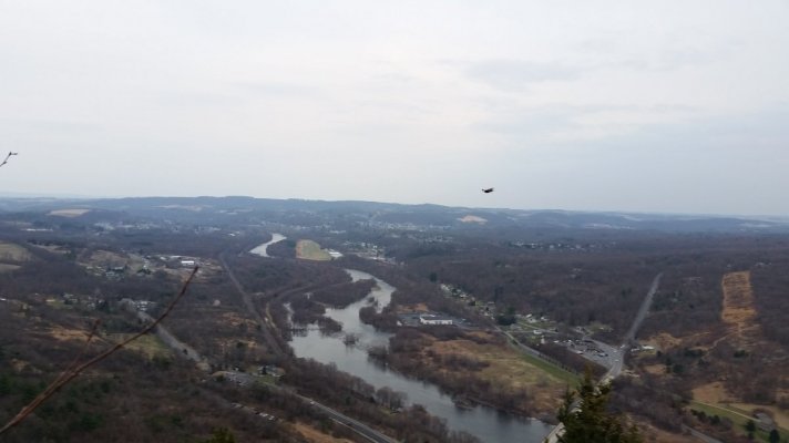
That's the Lehigh River down in the valley where this part of the trail starts.
1665527504253.jpeg

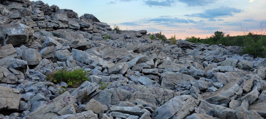
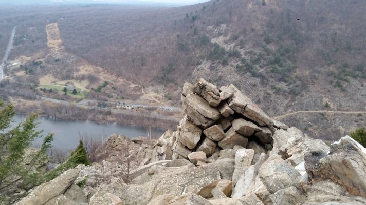
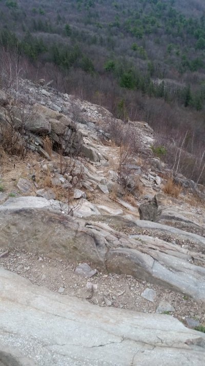
This is actually a marked part of the trail. You can see a white blaze on the rocks in the picture center, not a trail for beginners! You can kind of see the trail going down through the middle of the pic.
1665527589448.jpeg
 
Last edited:

tabvette

FRF Addict
Joined
Jun 16, 2021
Posts
2,120
Reaction score
3,444
Location
Canandaigua, New York
First, I’ll throw a picture of my Raptor Off-Roading to satisfy the thread requirements. You know this is the only place I know to post ;) Besides, 4x4 and 4xFoot are synonymous to me :)

NEAR DISASTER IN THE DESRT…
Earlier this year, my friend asked me to take him and his nieces hiking. The girls are in late 20’s, extremely smart ( both master degrees working on PhD’s m with incredibly bright futures). They had not hiked much before, but were extremely excited to learn and enjoy the Amazing hikes w/in a 150 radius of Vegas. I took them to one of my favorite hikes on the AZ side of the Colorado River, that leads to the River, through some wide slots/Canyons and Incredibly Beautiful Desert. They were hooked! They loved the hike and swore to get out as often as they could. All along the hike, I tried to share my vast wealth of worthless knowledge. I talked so much, I gave myself a headache. I told them that the Desert Is Not Your Friend. It will try and kill you if you give it a chance.
I emphasized the IMPORTANCE OF MFING WATER!! NEVER, NEVER AND NEVER go out with less than a 3L Bladder in your pack and preferably another 1/2 L in a Yeti in case your bladder fails.
ALWAYS Stop, turn around and make a mental or actual picture of what you should be looking at on your return to the Trailhead. Do this every 1/4 mile or so or every turn in the Trail and especially at any Forks/Y’s/T’s or other washes that may throw you off on your return. Another great option is to build a small Rock Carin to indicate your direction of travel. ALWAYS HAVE AN ESCAPE AZIMUTH, should you get yourself totally Fuxcked, you can Un-Fuxk yourself by using your Escape Azimuth.
Always let someone know where your Trailhead is ( common sense- see movie 27hrs)
Get yourself an IN-REACH Rescue Satellite Communicator and Download the GIA App.
All of these rules are equally applicable, 4x4 or 4xFoot.
I assumed they were at listening to some of the information I offered.

YESTERDAY : The girls decided to head down to the River again, on the AZ side, to a Trailhead that I had pointed out on our previous Adventure. it’s closer and comes out near the Hoover Dam, featuring a Beautiful/Rare Desert Waterfall and a patch of Palm Trees that appear to have been dropped out of the Sky, into the Desert. The PROBLEM, this is NOT a Novice Hiker, Hike. On my Handiman (in Living Colors) scale it is a very difficult hike, based on elevation +/- 2300’ and very difficult Route Finding.
The last time I did it, I was borderline Heat Exhaustion.
The Temperature at Hiking time was mid 90’s
I was sitting at home ( obviously, I’m fning stuck here with this Mfing knee) and Mark called. He said Darrren, the girls father, had called him. He said the girls called him panicked (BLIND MFING LUCK THAT THEY HAD CELL COVERAGE) They were LOST AND ALMOST OUT OF WATER!!
He told Mark he had been tracking them on their cell phone (Agin BFL that they had coverage) I told him to tell them to STAY PUT, find shade and Do Not Move from the location of that Screen Shot!
NPS SAR was called and Mark and Darren went to meet them and the Trailhead and Hike down with SAR to the Girls. They both carried a BUNCH of Water.
I went to my GAIA APP and found the Hike. I sent them 2 pictures and said, “This is where you will find them”. Mark and Darren met the SAR Rangers (Fantastic Dudes, one‘s previous post was Arches NP, Mark said that guy was a mfing Billygoat) and headEd out to find the girls. They shared the information that I had given them to the SAR Rangers. They Found the Girls EXACTLY WHERE I SAID THEY WOULD BE! (Note, I was cheating. I had rescued a couple from that exact point on my last hike) If you weren’t following my rules above, you would get lost at this Y in the Trail.
The Girls were dehydrated and scared but otherwise fine, Thank God. Thank God for Random cell service in the Remote Desert!
Mark and Darren called and thanked me. Darren still couldn’t believe that I knew exactly where they would be. I’m angry that I wasn’t able to join them on their Rescue Adventure :( but I’m glad I was able to play a small part in their safe recovery.
Darren has told them that they ARE NOT GOING OUT AGAIN until they have the GAIA APP and he buys them the GARMIN IN-REACH.
The Girls were using the All-Trails App. A great App for finding Trails that you would like to hike and getting hike descriptions. IMHO AND THE SAR RANGERS, IT IS NOT A NAVIGATION APP!
I have previously rescued a girl at Lake Mead in the Red Stone area, that was using All-Trails for Navigation.

I apologize for being long winded, but you should know by now, I love the sound of my voice :happy175::head3:besides, all I have to do now is Therapy and Bore the Shixt out of you guys ;)

If this helps one other person, I didn’t waste my breath…
STAY SAFE OUT THERE-NATURE ALWAYS WINS
-Randy Morgenson-
Back Country Ranger, killed in the LOD and the subject of the Largest SAR (Search And Rescue) mission ever undertaken by the NPS
View attachment 375102View attachment 375103View attachment 375104View attachment 375105View attachment 375106
You lost me after the handiman reference. I loved in living color. Handiman was the greatest super hero ever.
 

P4SHOCAT

FRF Addict
Joined
Aug 17, 2019
Posts
2,307
Reaction score
1,587
Location
Glenside Pa.
View attachment 375193

View attachment 375194

That's the Lehigh River down in the valley where this part of the trail starts.
View attachment 375195

This is actually a marked part of the trail. You can see the blazes on the rocks, not a trail for beginners! You can kind of see the trail going down through the middle of the pic.
View attachment 375196
Oldfart, are those pictures closer to Leighton or to Easton. Looks like a good hike for the wife and I. Great pictures.
 

Oldfart

FRF Addict
Joined
Oct 21, 2017
Posts
5,968
Reaction score
14,799
Location
Saggy Balls Division of Trump Army
Oldfart, are those pictures closer to Leighton or to Easton. Looks like a good hike for the wife and I. Great pictures.
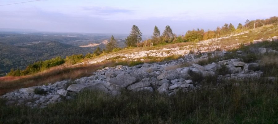
Thanks, most are on the main ridge that runs between the Lehigh River gap, which is on the opposite (south) side of the mountain from Palmerton, and the next gap east, which is right by Blue Mountain ski area. Palmerton is about 10 minutes south of Lehighton.

A real nice way to tour the mountain is to start across the road from Blue Mountain ski. There is an access road about 200 feet north from the AT that my friend built as he's contracted for rehabbing the mountain with new trees and grasses. It's a 4X4 road and is a great way to get up onto the top and hike the ridge. Hiking up the rocks is not for everyone, including me sometimes. The 4X4 road makes it a lot easier. Once you get up top you are back on the AT again.

If you don't mind doing some bouldering you can go up the steep side right from the river, that's where many of the nice views are. Many of my pics are from some ridge points there, you can often see eagles cruising the valley. The trail is pretty well marked with white paint blazes. I also hike up in the dark sometimes, it's REALLY quiet!

Feel free to PM me if you think you want to go there some time. If I can't get free to show you, I can at least give you A LOT of info on where and how you might like to hike. You can do from easy to really bust your balls depending on your route. If you are going fall or winter, get off early because the sun drops really fast. I've been surprised more than once, that's how I found out I actually like it up there in the dark at times. It taught me to be a headlamp, flashlight, and a charged phone kind of guy!
 
Last edited:

P4SHOCAT

FRF Addict
Joined
Aug 17, 2019
Posts
2,307
Reaction score
1,587
Location
Glenside Pa.
Thanks, most are on the main ridge that runs between the Lehigh River gap, which is on the opposite (south) side of the mountain from Palmerton, and the next gap east, which is right by Blue Mountain ski area. Palmerton is about 10 minutes south of Lehighton.

A real nice way to tour the mountain is to start across the road from Blue Mountain ski. There is an access road about 200 feet north from the AT that my friend built as he's contracted for rehabbing the mountain with new trees and grasses. It's a 4X4 road and is a great way to get up onto the top and hike the ridge. Hiking up the rocks is not for everyone, including me sometimes. The 4X4 road makes it a lot easier. Once you get up top you are back on the AT again.

If you don't mind doing some bouldering you can go up the steep side right from the river, that's where many of the nice views are. Many of my pics are from some ridge points there, you can often see eagles cruising the valley. The trail is pretty well marked with white paint blazes. I also hike up in the dark sometimes, it's REALLY quiet!

Feel free to PM me if you think you want to go there some time. If I can't get free to show you, I can at least give you A LOT of info on where and how you might like to hike. You can do from easy to really bust your balls depending on your route. If you are going fall or winter, get off early because the sun drops really fast. I've been surprised more than once, that's how I found out I actually like it up there in the dark at times. It taught me to be a headlamp, flashlight, and a charged phone guy!
Thanks, I am familiar with blue MTN. Problem I have now is 84 yr old mother in law with dementia living with us. Hard for both of us getting away together. If you ever get the urge to shoot some sporting clays, hit me up and I could meet you at Lehigh valley sporting clays.
 

Oldfart

FRF Addict
Joined
Oct 21, 2017
Posts
5,968
Reaction score
14,799
Location
Saggy Balls Division of Trump Army
Thanks, I am familiar with blue MTN. Problem I have now is 84 yr old mother in law with dementia living with us. Hard for both of us getting away together. If you ever get the urge to shoot some sporting clays, hit me up and I could meet you at Lehigh valley sporting clays.
Thanks. Sorry to hear about your MIL, that's a tough one. It's only my dad and I left, and he went in a nursing when he was 97 3 years ago. I haven't used a shotgun in many years, I've been all AR, PCC, and pistols. I'd probably have a better chance with my pistol than with my shotgun!
 

P4SHOCAT

FRF Addict
Joined
Aug 17, 2019
Posts
2,307
Reaction score
1,587
Location
Glenside Pa.
Thanks. Sorry to hear about your MIL, that's a tough one. It's only my dad and I left, and he went in a nursing when he was 97 3 years ago. I haven't used a shotgun in many years, I've been all AR, PCC, and pistols. I'd probably have a better chance with my pistol than with my shotgun!
Sorry about your dad. My parents live in the Poconos. Dad's 85 with Alzheimer's so I try to get up there as much as I can. I do shoot all the other guns as much as I can. Nice being retired.
 
Top