treypal
Lord of the Raptors
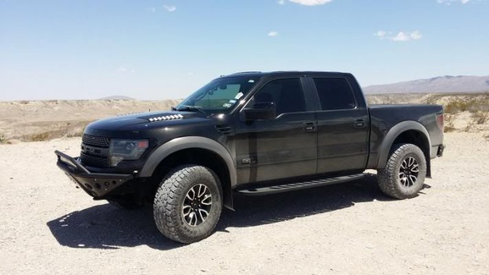
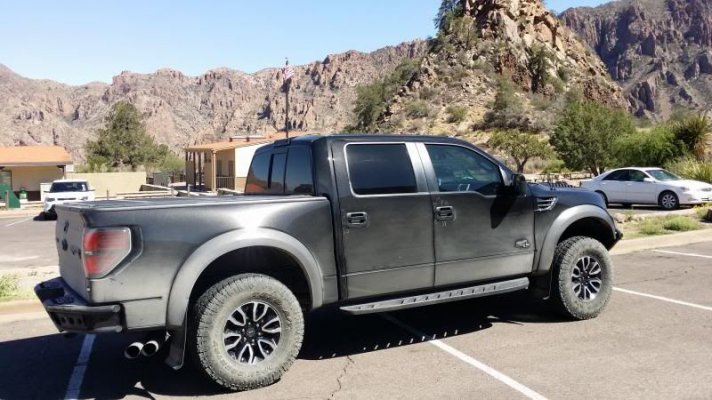
Back in January, I lead a group of Raptors through Big Bend National Park. Wheeling in the park has been on my list of things to do for a long time, and it's one of the only places open to the public in Texas where you can take a Raptor offroading. Sure there is speedlimits, but fortunately my prerunner doesn't have a speedo...
We left out of Corpus early on a Thursday morning, and it felt like we were making great time. Until we got to Sanderson, and still had like 150 miles to go, just to get to the park turnoff. From there it's another 50 miles to Panther Junction, which is the junction with the road that runs East and West in the park. The visitor center had just closed. Top Tip, if you plan on getting to the visitor center right at their 5 PM closing, odds are they have already been closed for a while. We decided to find a primative roadside camp for the night, and head into the Chisos Basin in the morning. Not exactly an easy task in a long bed F350 towing a 22' trailer with a prerunner on it. We preran a few sites (Hiked), and found one that would work. We ended up finding one down a long dirt road, setup camp, called it a night.
Just as we fell asleep a car pulled up. Hippies in a prius. "Uh, you took our campsite man". me "There wasn't anyone here when we got here". hippie "Uh, you gotta reserve these man". WTF reserve campsites in the middle of the friggin desert? I wasn't backing down, we were already in bed. So I told him we could share. Finally they gave in, but they weren't happy about it. They left before the sun came up... I froze my ass off because I stupidly washed my sleeping bag in the washer and somehow washed the warm out of it. Sucked.
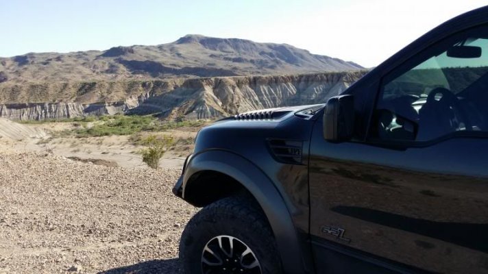
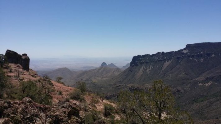
View from our campsite.

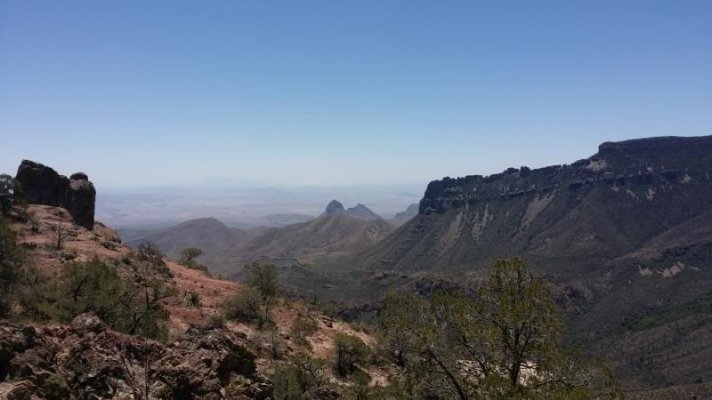
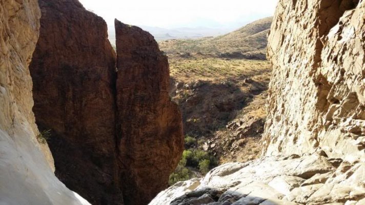
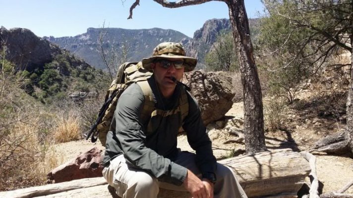
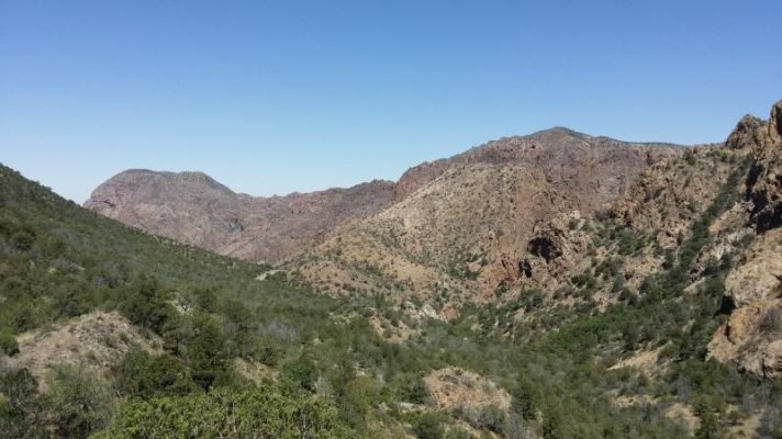
Next day we headed to our final camp/lodge location of the weekend, the Chisos Basin. The road was littered with signs about bringing a trailer over 20' up the road due to the steep grade and switchbacks. The prerunner trailer is 22'. No biggie, it was just like SW Colorado or Baja. Barked a few tires and put on a show for the priuses. Unloaded the prerunner, setup camp and set off for a day of scouting in the prerunner. But first we decided to hike The Window. It's the most famous hiking trail in the park, and the views at the end are spectacular. I didn't have my SLR with me, so the pics aren't the greatest, but it was absolutely awesome.

Big Bend has a border crossing to the small tourist town of Boquillas. This crossing has been closed since just after 9/11, but in April of 2013 it reopened. It has virtual terminals to talk to CBP agents when you come back. It's the only virtual terminal on the US Mexico border. Put your passport on the scanner, pick up the headset and talk to a border agent in El Paso. Pretty cool.
The town is a lot like the Robert Earl Keen song "****** Honeymoon". They row you across, you can rent donkeys to ride the 3/4 mile into town. We walked. The "Town" was interesting, two restaurants and a bar, right on the Rio Grande, it was pretty spectacular. I talked with a few locals who owned a nice restaurant and bar (the spoke perfect english, which I found strange). The other odd thing was, for a town with no income, they all were wearing fairly nice clothes, the horses donkeys and cows were all pretty healthy for being the middle of the desert. I've been to Baja, and I've seen poor Mexico. This wasn't it. I don't know where they get their money, but if I had to guess, I'd say mining. Anyways, the whole experience was a lot of fun, and gave us more of the Baja feel that we're always looking for.


Another freezing night in my ruined bag, with the only glimmer of hope being that we were staying in the Chisos Mountain Lodge for the rest of the weekend.
Saturday was our first day as a group on the trails, or primative roads as they are called in the park. We headed west on the main park road, until it hooked up with Old Maverick Road which we took down to Santa Elena Canyon. It was absolutely spectacular down there, and made for some really cool shots with all of the Raptors.


From there we headed East on the River Road. To me, this road was really similar to the terrain we run across in Baja. Washes, rocks, mesquite. Lots of fun. River Road is 51 miles long, I wouldn't suggest going alone unless you had some sort of beacon like a SPOT. There wasn't anything dangerous or too difficult for a Raptor, but this park is huge, and if you had a problem it could be days before you were found. River road led us back to the main paved road. We continued East to check out the Rio Grande Village (Not much there). Then we headed to the Hot Springs, which were pretty cool. I stuck my head in, pissing off the hippies looking for some peace and quiet.

From there took the pavement back to Panther Junction for gas, then into the Basin for dinner and a much needed shower. Total distance 135 miles.


Old Mine.

We got warned that the bricks from the mine contained a bunch of mercury.


Circle the Raptors.


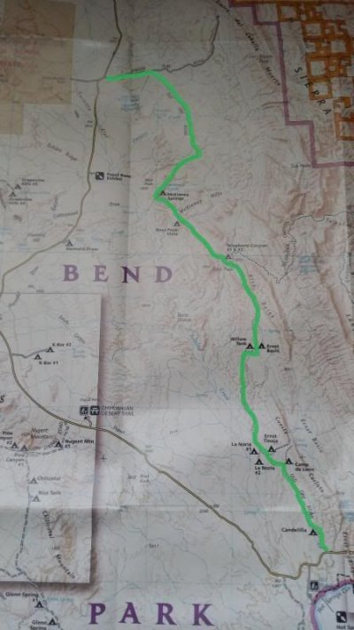
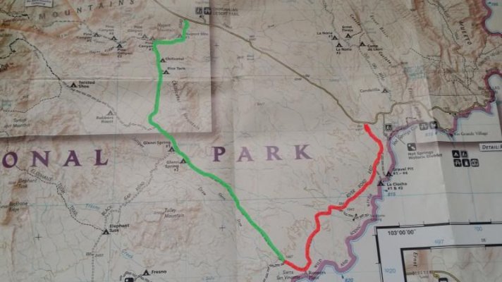
Sunday's plan was to take the Dagger Flat Auto trail to the Old Ore Road, then to Take River Road East to Glenn Spring Road. Total distance 140 miles. The Dagger Flat Trail was a ton of fun. We ran it to the dead end, then headed back out one at a time for a photo op. It's a twisty but smooth road, really easy to get some speed and have some fun. From there it was the Old Ore Road, which was a very rocky, much slower paced trail. One guy ended up getting stuck and having a double flat. New one for me.

There was lot's of geology on the trail to see, and we stopped at a very cool rock formation called, the Ernst Tinaja, it's definitely worth a look.

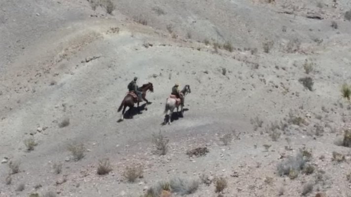
We had lunch there before continuing on. We traveled back down River Road to the Glenn Springs Road junction, and took Glenn Springs back north to the paved road. This is another fun, fast road, and I highly recommend it. From there it was pavement back to the basin, concluding our adventure. I highly recommend this trip to anyone looking for some longer distance wheeling in Texas. The part is truly amazing, and even though we covered almost every primitive road in the park, there is still the State Park next door, and a few other roads. Safety is a concern however. We met some unrelated guys in a Raptor who had their truck broken into by guys on horseback while they were out hiking, so I suggest traveling in groups and not leaving anything unattended for very long. If anyone is interested in a return trip, I plan on putting one together very soon.

White Thunder lead the way.

Sunset in the Chisos Basin.

pffft.

Headsets make everything cooler.

One of these is not like the other.

We left out of Corpus early on a Thursday morning, and it felt like we were making great time. Until we got to Sanderson, and still had like 150 miles to go, just to get to the park turnoff. From there it's another 50 miles to Panther Junction, which is the junction with the road that runs East and West in the park. The visitor center had just closed. Top Tip, if you plan on getting to the visitor center right at their 5 PM closing, odds are they have already been closed for a while. We decided to find a primative roadside camp for the night, and head into the Chisos Basin in the morning. Not exactly an easy task in a long bed F350 towing a 22' trailer with a prerunner on it. We preran a few sites (Hiked), and found one that would work. We ended up finding one down a long dirt road, setup camp, called it a night.
Just as we fell asleep a car pulled up. Hippies in a prius. "Uh, you took our campsite man". me "There wasn't anyone here when we got here". hippie "Uh, you gotta reserve these man". WTF reserve campsites in the middle of the friggin desert? I wasn't backing down, we were already in bed. So I told him we could share. Finally they gave in, but they weren't happy about it. They left before the sun came up... I froze my ass off because I stupidly washed my sleeping bag in the washer and somehow washed the warm out of it. Sucked.
View from our campsite.
Next day we headed to our final camp/lodge location of the weekend, the Chisos Basin. The road was littered with signs about bringing a trailer over 20' up the road due to the steep grade and switchbacks. The prerunner trailer is 22'. No biggie, it was just like SW Colorado or Baja. Barked a few tires and put on a show for the priuses. Unloaded the prerunner, setup camp and set off for a day of scouting in the prerunner. But first we decided to hike The Window. It's the most famous hiking trail in the park, and the views at the end are spectacular. I didn't have my SLR with me, so the pics aren't the greatest, but it was absolutely awesome.
Big Bend has a border crossing to the small tourist town of Boquillas. This crossing has been closed since just after 9/11, but in April of 2013 it reopened. It has virtual terminals to talk to CBP agents when you come back. It's the only virtual terminal on the US Mexico border. Put your passport on the scanner, pick up the headset and talk to a border agent in El Paso. Pretty cool.
The town is a lot like the Robert Earl Keen song "****** Honeymoon". They row you across, you can rent donkeys to ride the 3/4 mile into town. We walked. The "Town" was interesting, two restaurants and a bar, right on the Rio Grande, it was pretty spectacular. I talked with a few locals who owned a nice restaurant and bar (the spoke perfect english, which I found strange). The other odd thing was, for a town with no income, they all were wearing fairly nice clothes, the horses donkeys and cows were all pretty healthy for being the middle of the desert. I've been to Baja, and I've seen poor Mexico. This wasn't it. I don't know where they get their money, but if I had to guess, I'd say mining. Anyways, the whole experience was a lot of fun, and gave us more of the Baja feel that we're always looking for.
Another freezing night in my ruined bag, with the only glimmer of hope being that we were staying in the Chisos Mountain Lodge for the rest of the weekend.
Saturday was our first day as a group on the trails, or primative roads as they are called in the park. We headed west on the main park road, until it hooked up with Old Maverick Road which we took down to Santa Elena Canyon. It was absolutely spectacular down there, and made for some really cool shots with all of the Raptors.
From there we headed East on the River Road. To me, this road was really similar to the terrain we run across in Baja. Washes, rocks, mesquite. Lots of fun. River Road is 51 miles long, I wouldn't suggest going alone unless you had some sort of beacon like a SPOT. There wasn't anything dangerous or too difficult for a Raptor, but this park is huge, and if you had a problem it could be days before you were found. River road led us back to the main paved road. We continued East to check out the Rio Grande Village (Not much there). Then we headed to the Hot Springs, which were pretty cool. I stuck my head in, pissing off the hippies looking for some peace and quiet.
From there took the pavement back to Panther Junction for gas, then into the Basin for dinner and a much needed shower. Total distance 135 miles.
Old Mine.
We got warned that the bricks from the mine contained a bunch of mercury.
Circle the Raptors.
Sunday's plan was to take the Dagger Flat Auto trail to the Old Ore Road, then to Take River Road East to Glenn Spring Road. Total distance 140 miles. The Dagger Flat Trail was a ton of fun. We ran it to the dead end, then headed back out one at a time for a photo op. It's a twisty but smooth road, really easy to get some speed and have some fun. From there it was the Old Ore Road, which was a very rocky, much slower paced trail. One guy ended up getting stuck and having a double flat. New one for me.
There was lot's of geology on the trail to see, and we stopped at a very cool rock formation called, the Ernst Tinaja, it's definitely worth a look.
We had lunch there before continuing on. We traveled back down River Road to the Glenn Springs Road junction, and took Glenn Springs back north to the paved road. This is another fun, fast road, and I highly recommend it. From there it was pavement back to the basin, concluding our adventure. I highly recommend this trip to anyone looking for some longer distance wheeling in Texas. The part is truly amazing, and even though we covered almost every primitive road in the park, there is still the State Park next door, and a few other roads. Safety is a concern however. We met some unrelated guys in a Raptor who had their truck broken into by guys on horseback while they were out hiking, so I suggest traveling in groups and not leaving anything unattended for very long. If anyone is interested in a return trip, I plan on putting one together very soon.
White Thunder lead the way.
Sunset in the Chisos Basin.
pffft.
Headsets make everything cooler.
One of these is not like the other.


